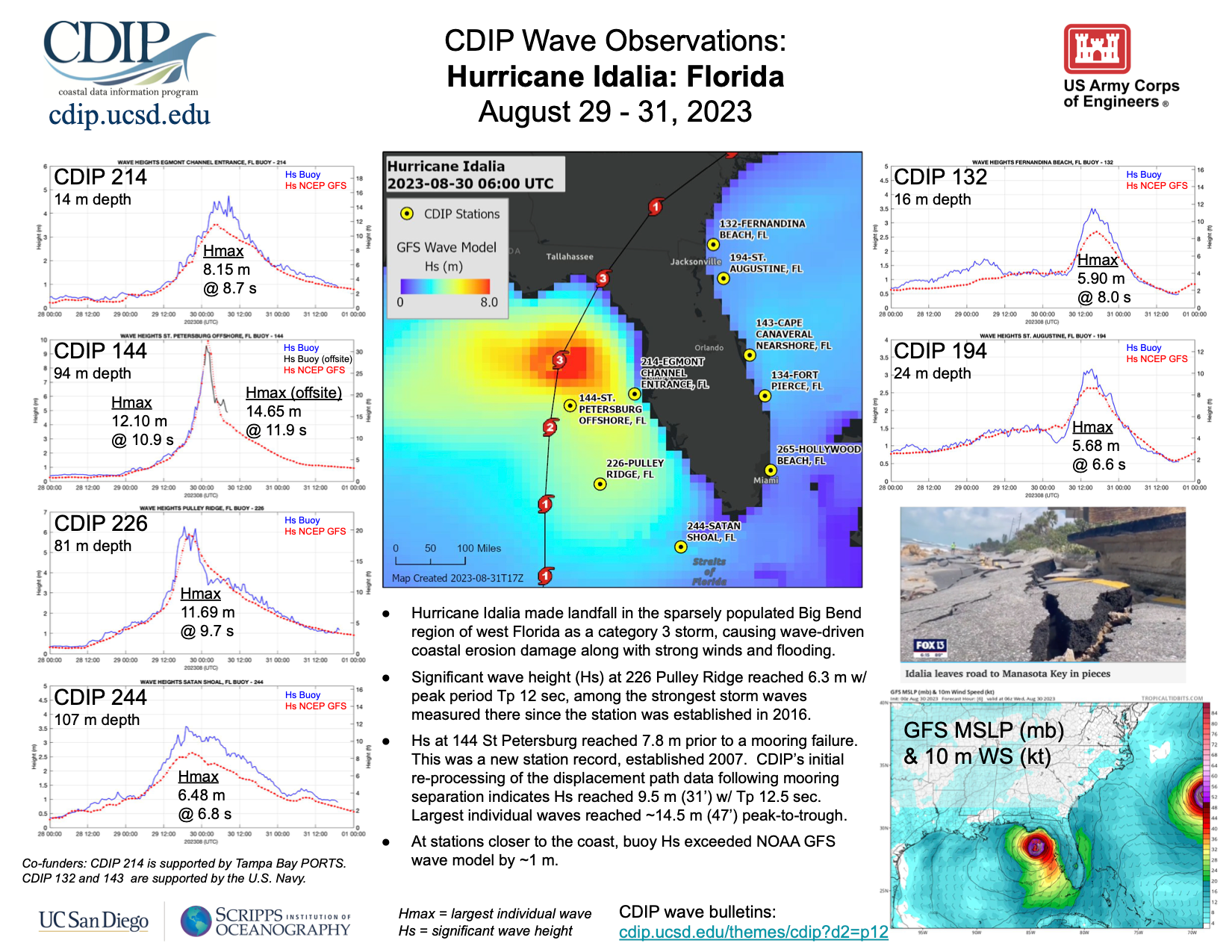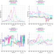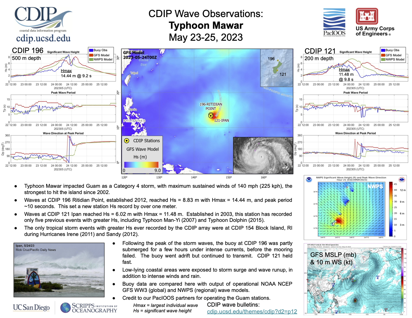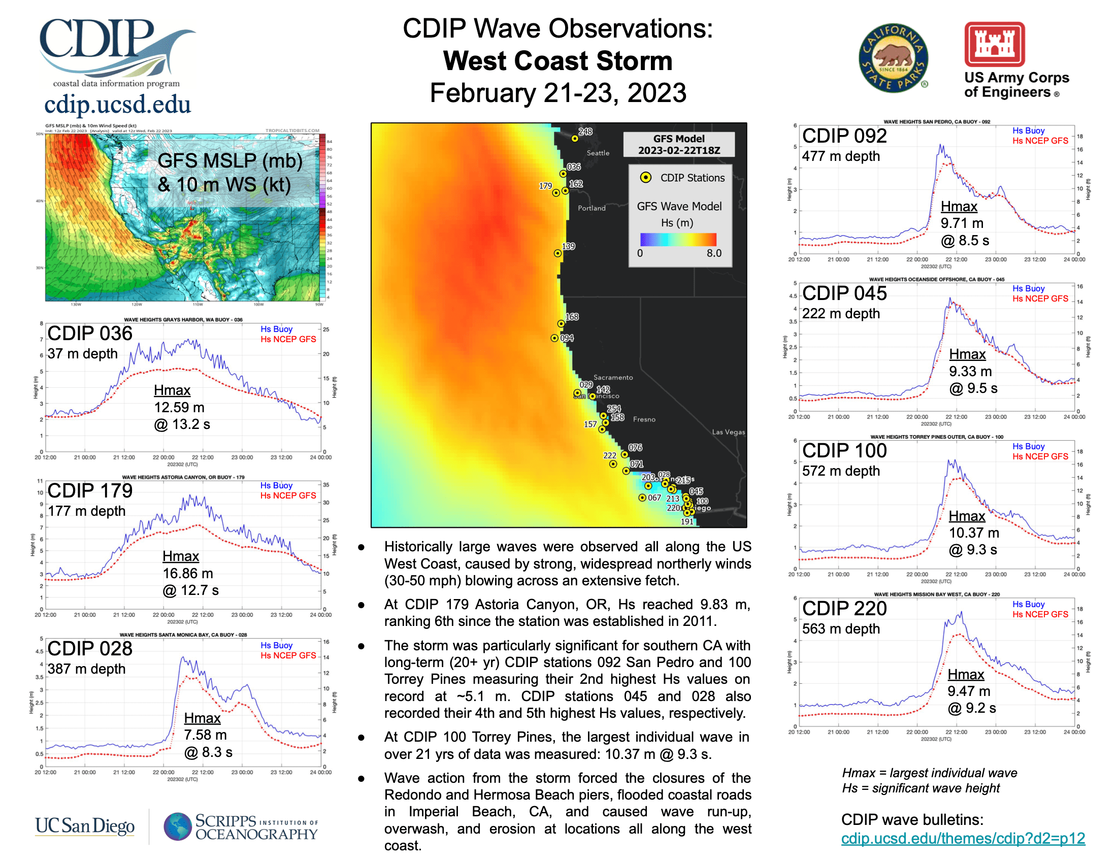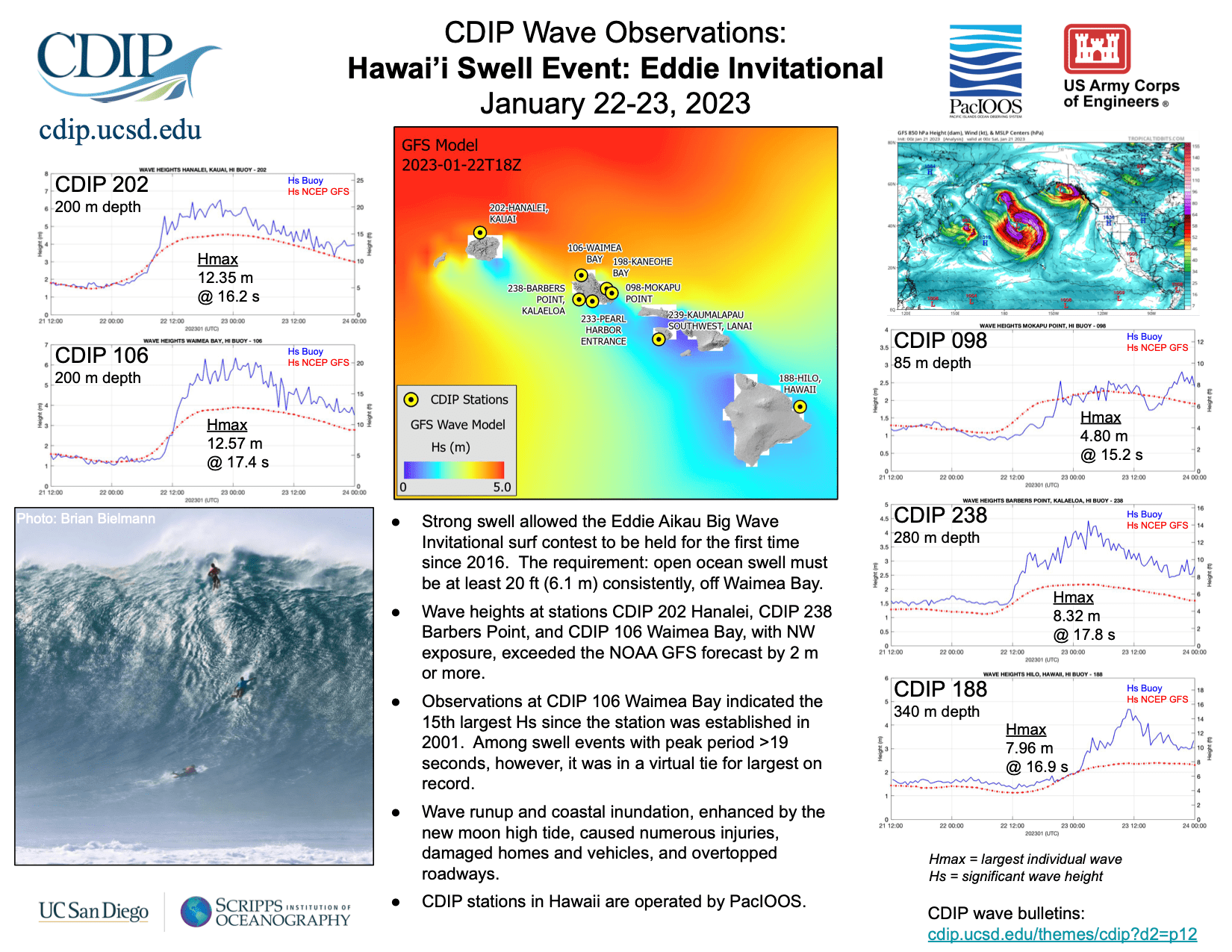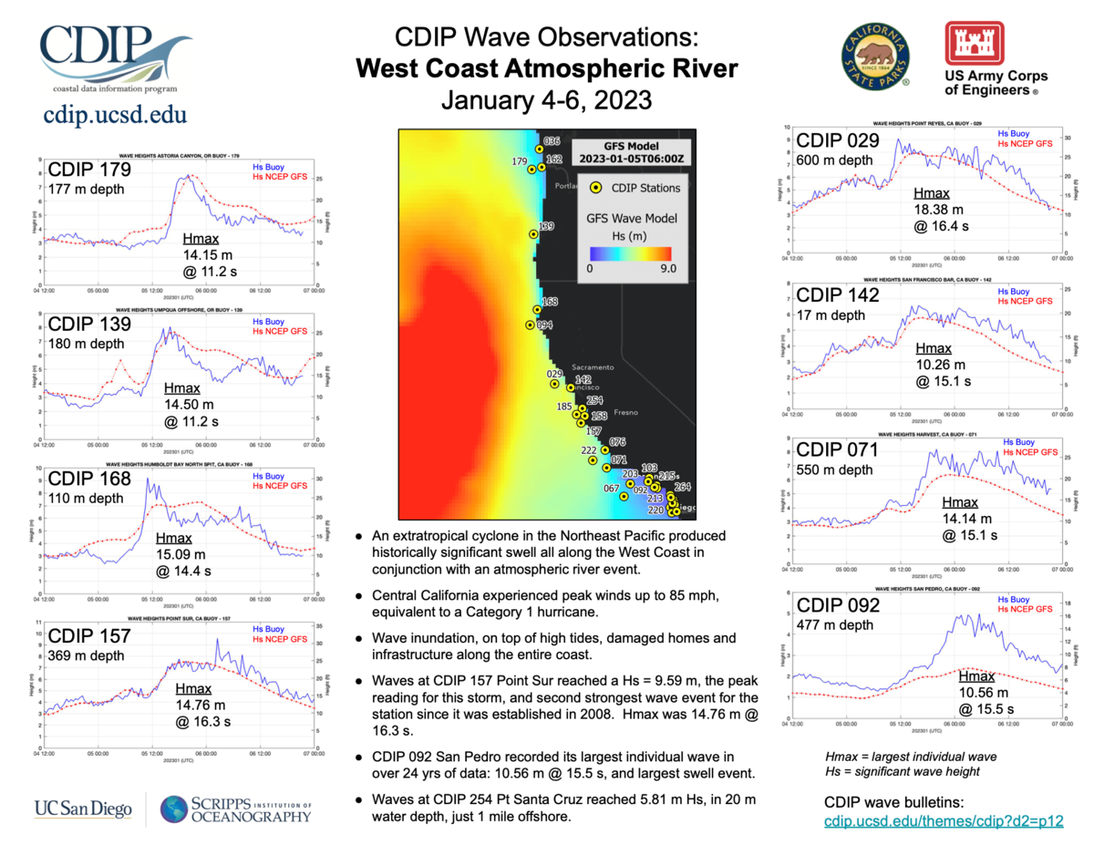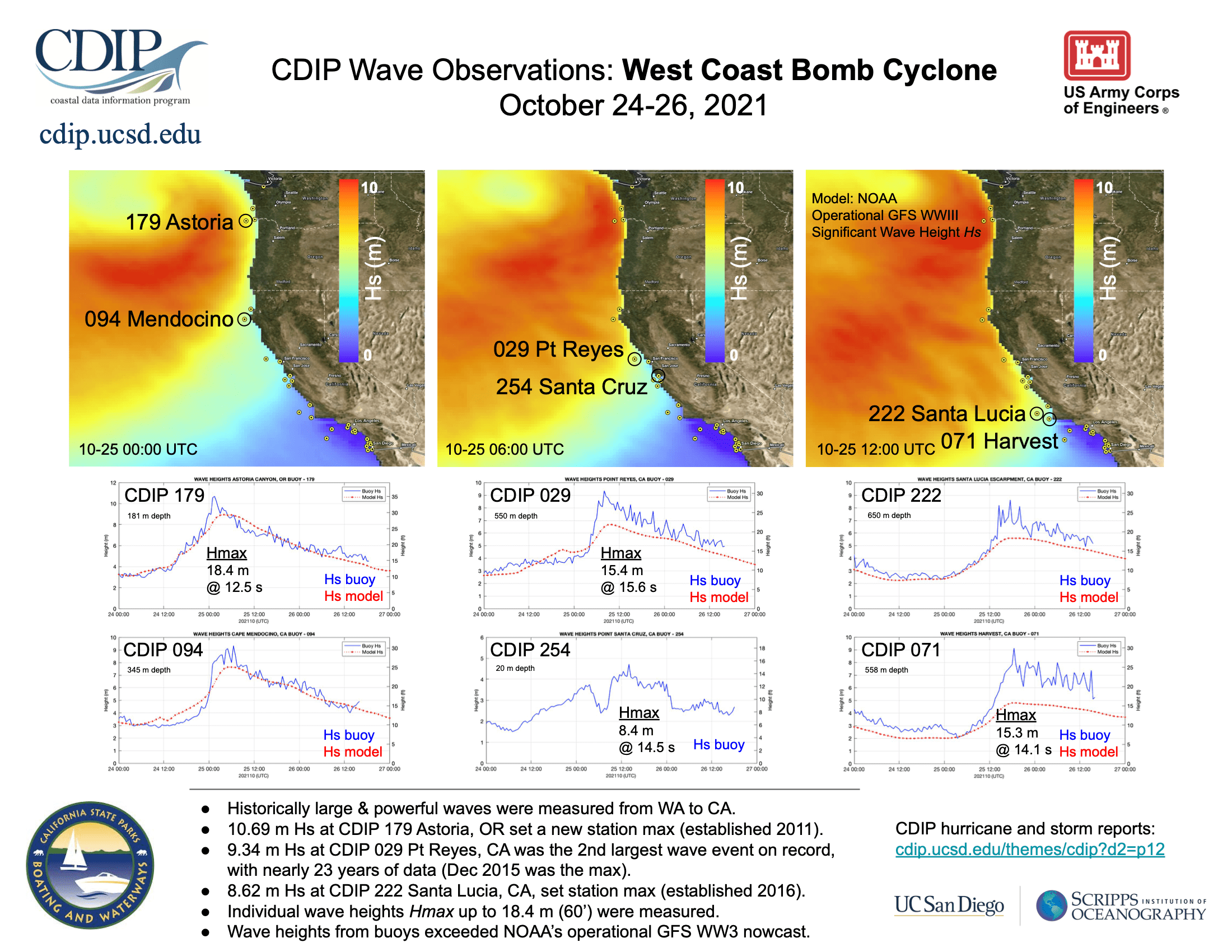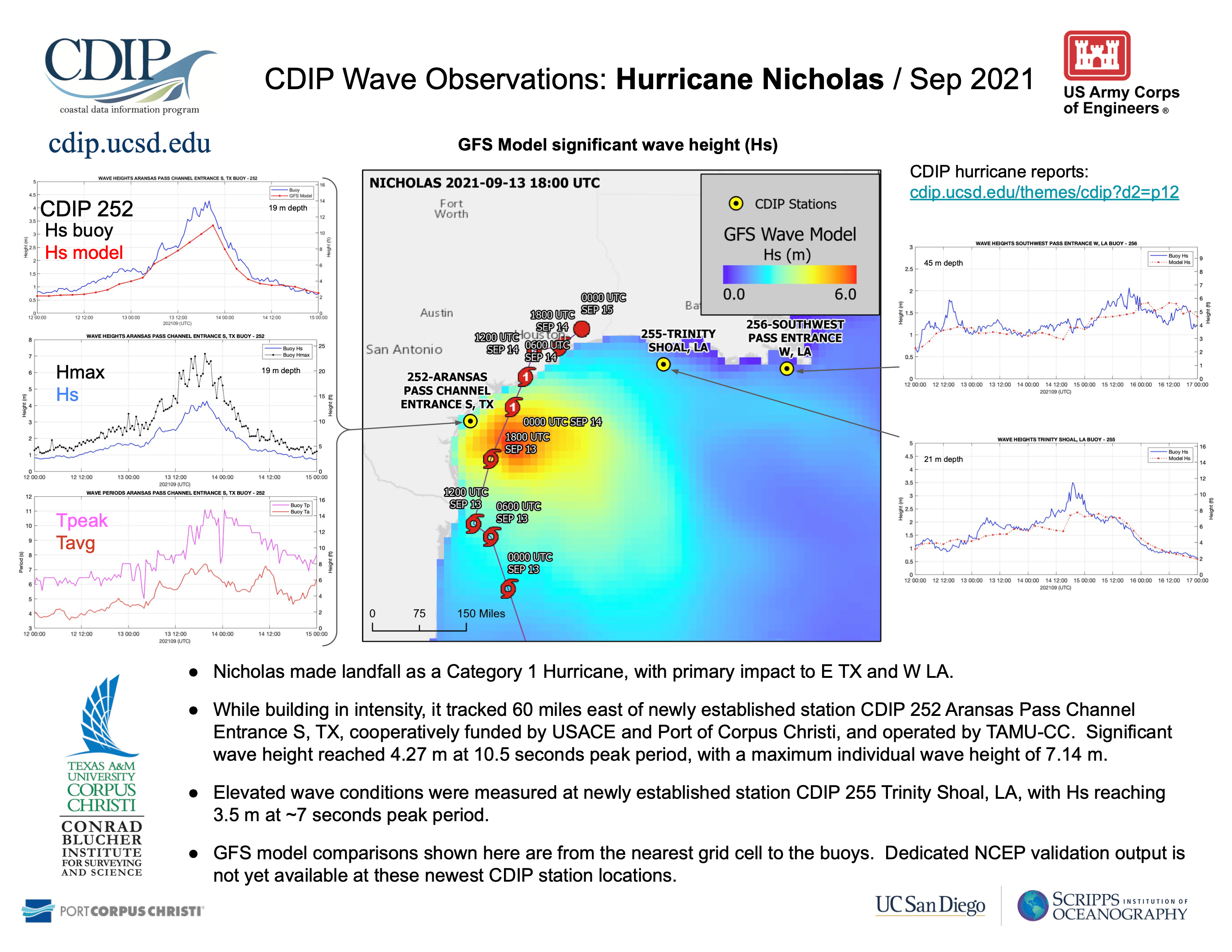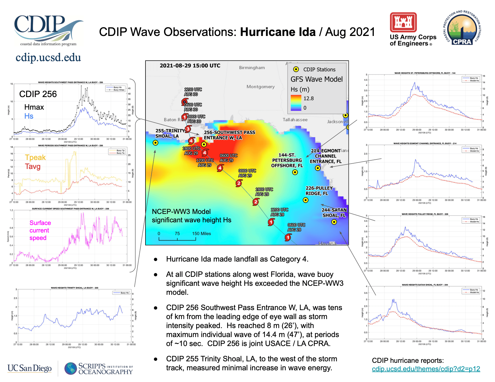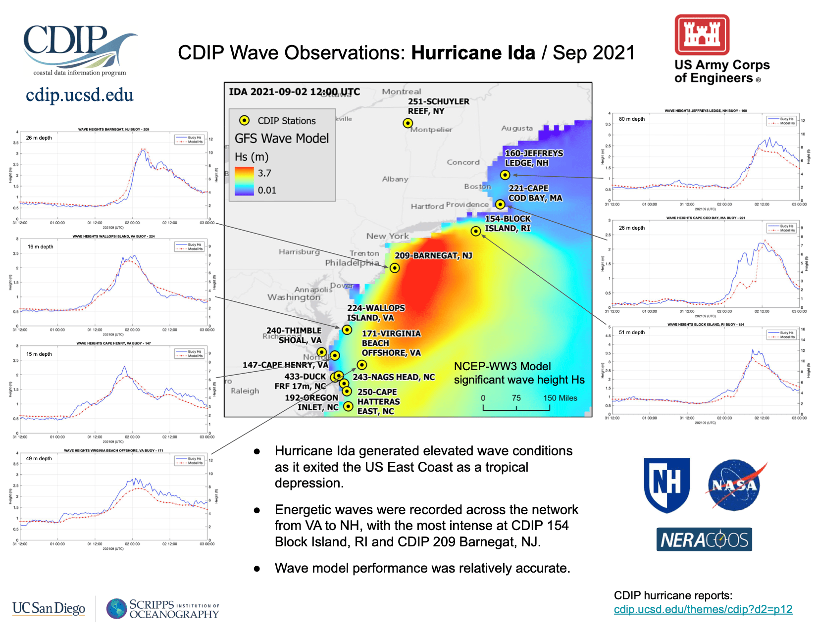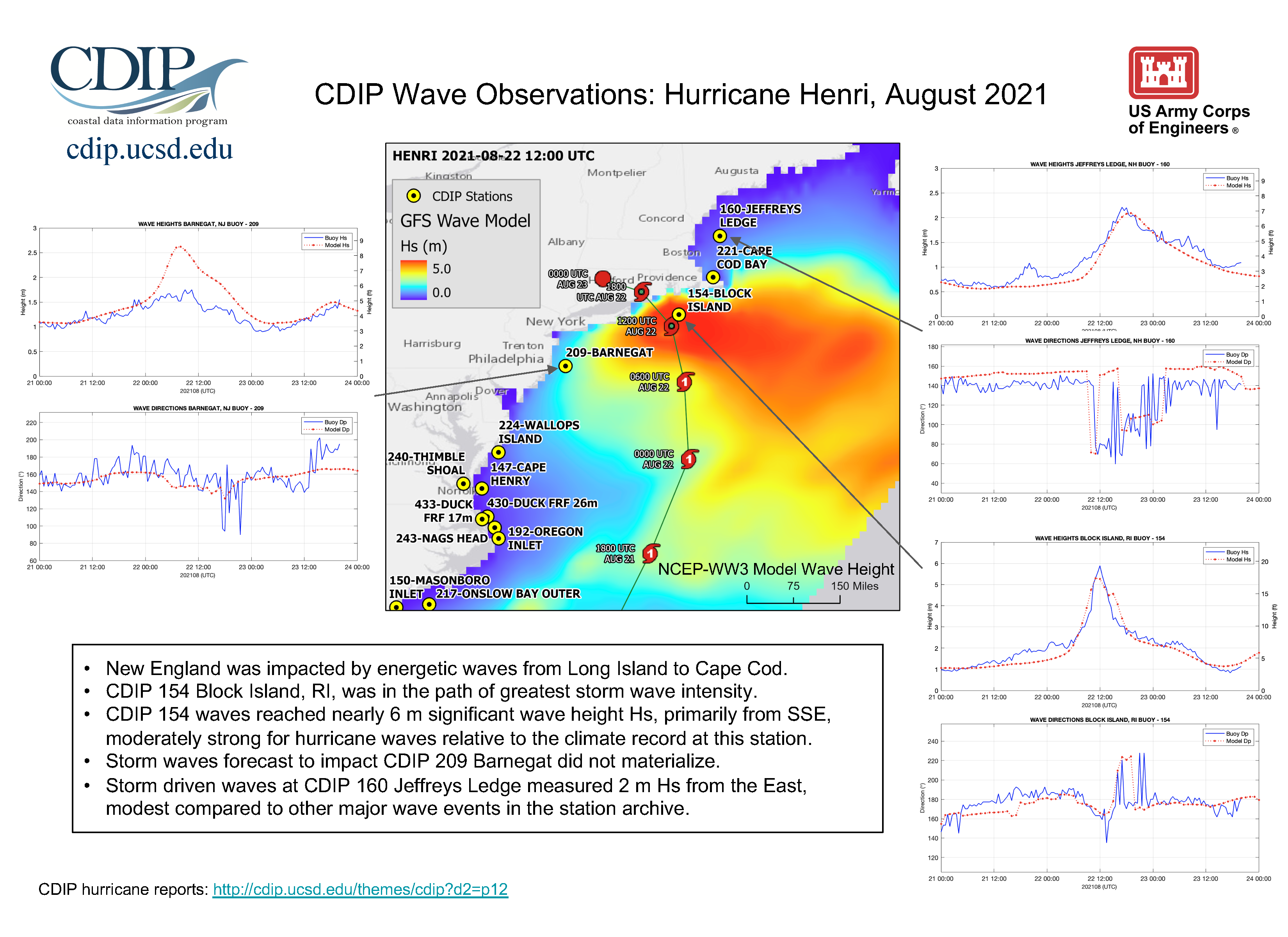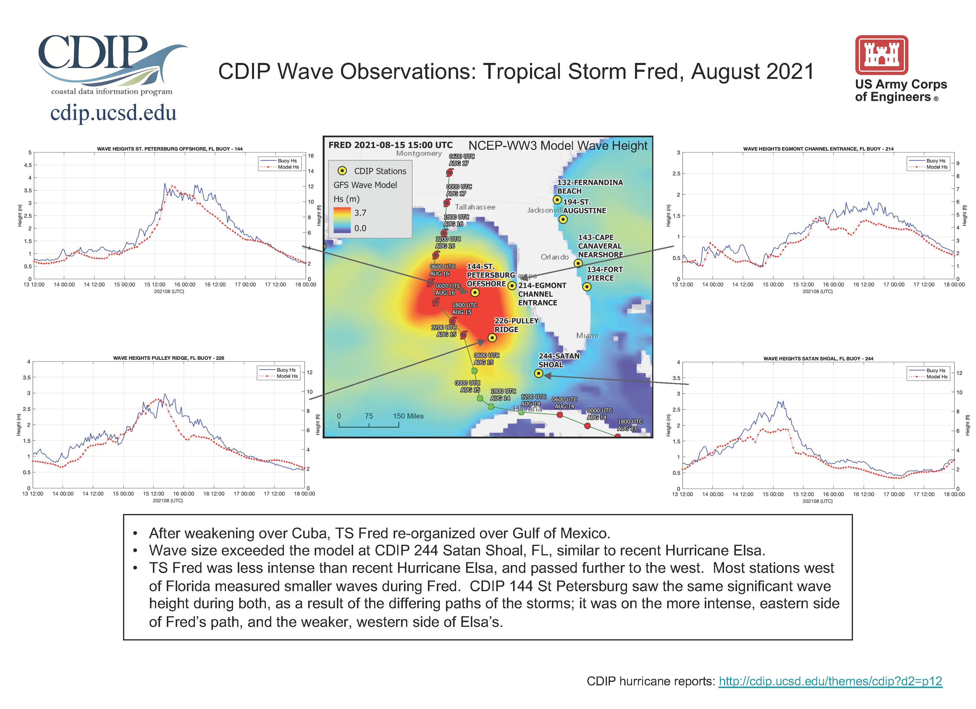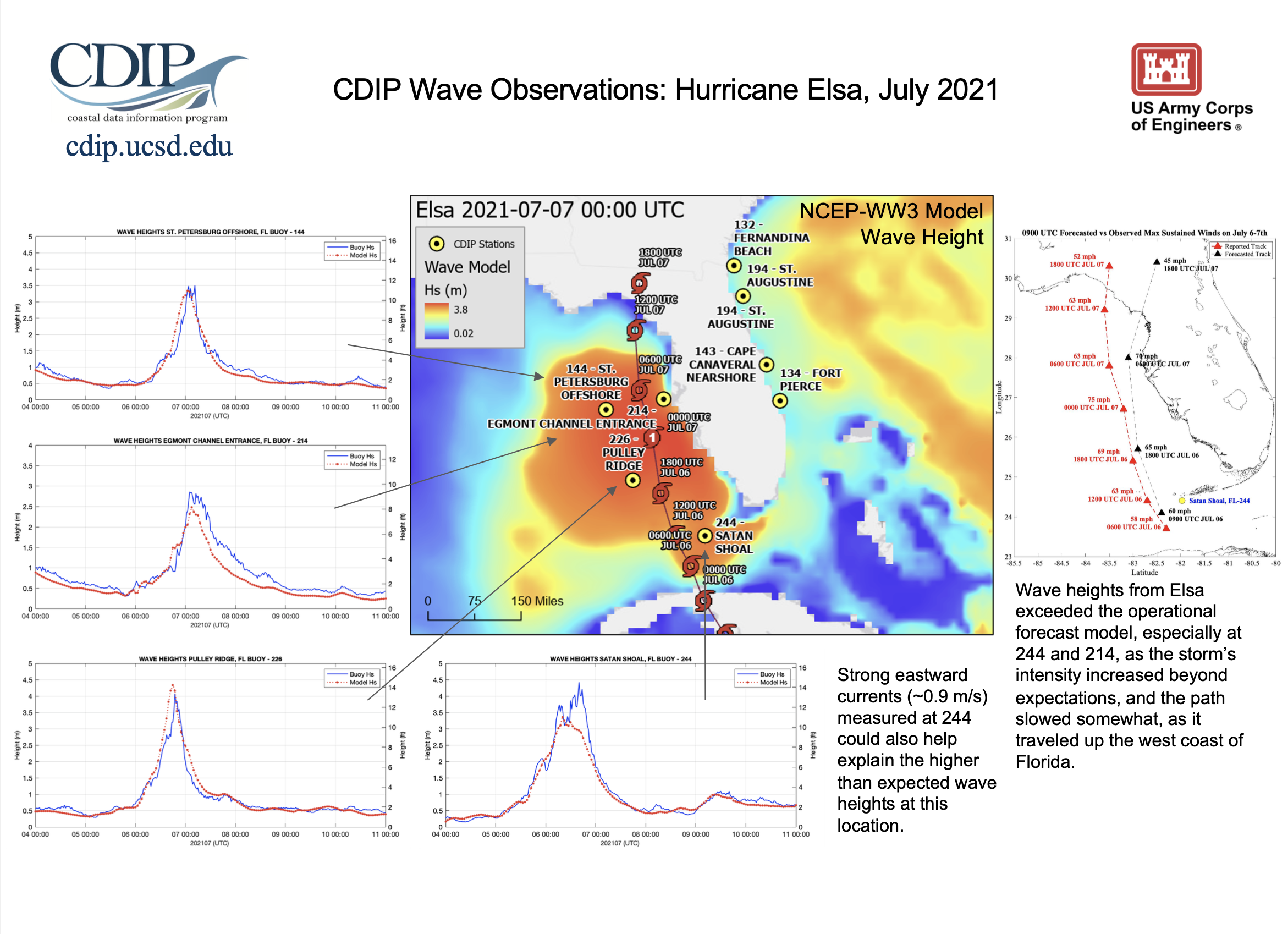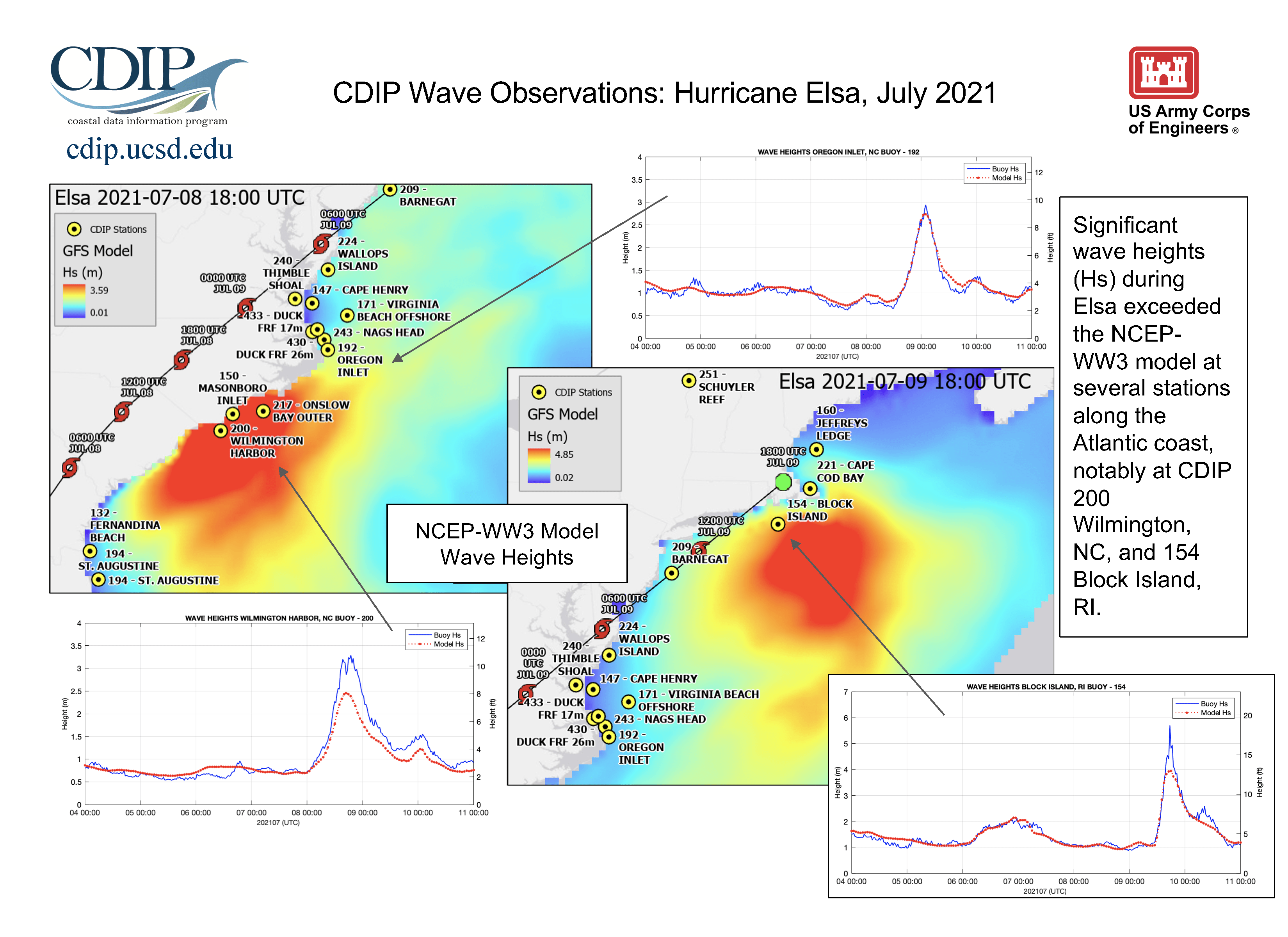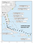
 More about Hurricane Elsa from wikipedia ...
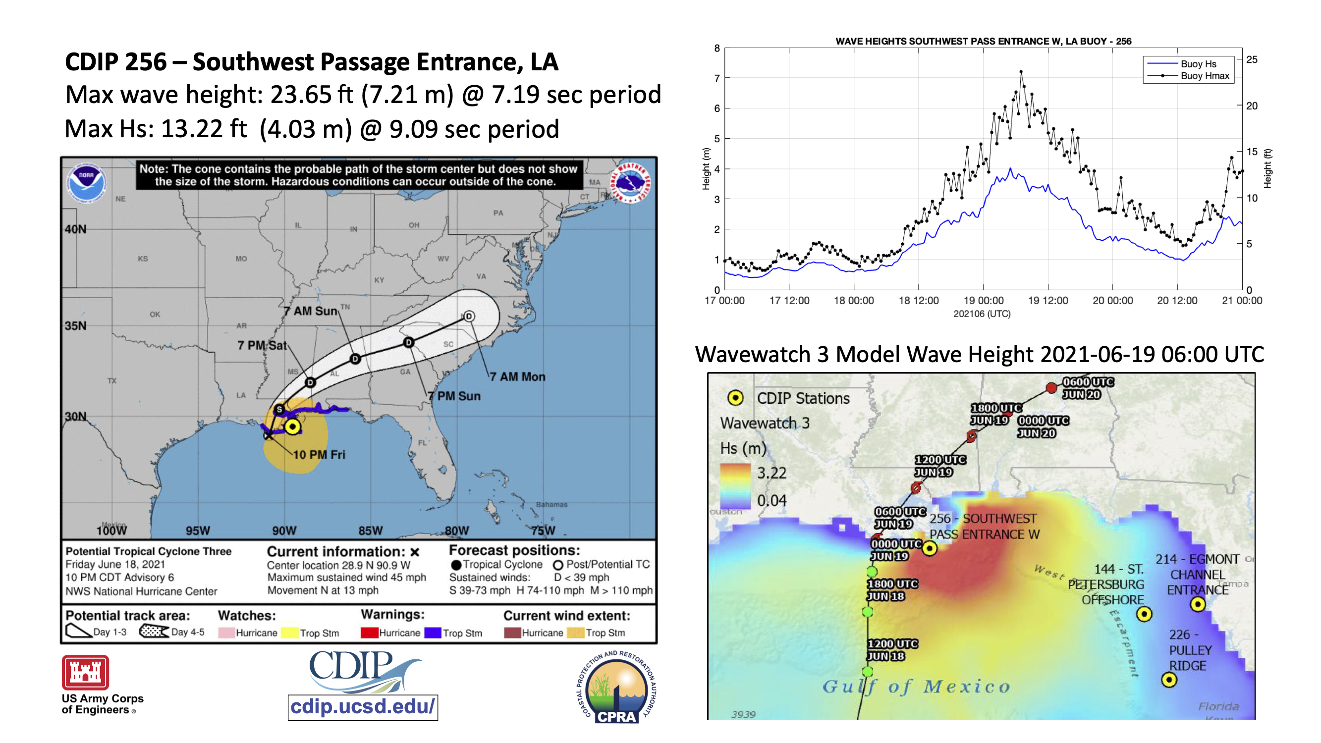
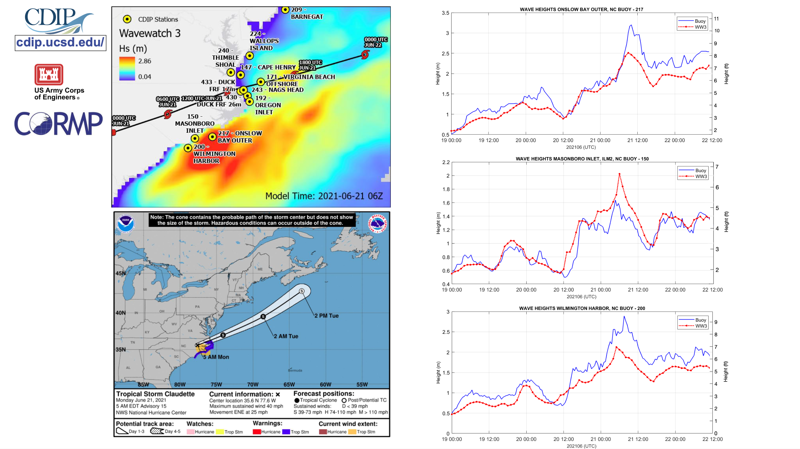
Tropical Storm Claudette - June 2021
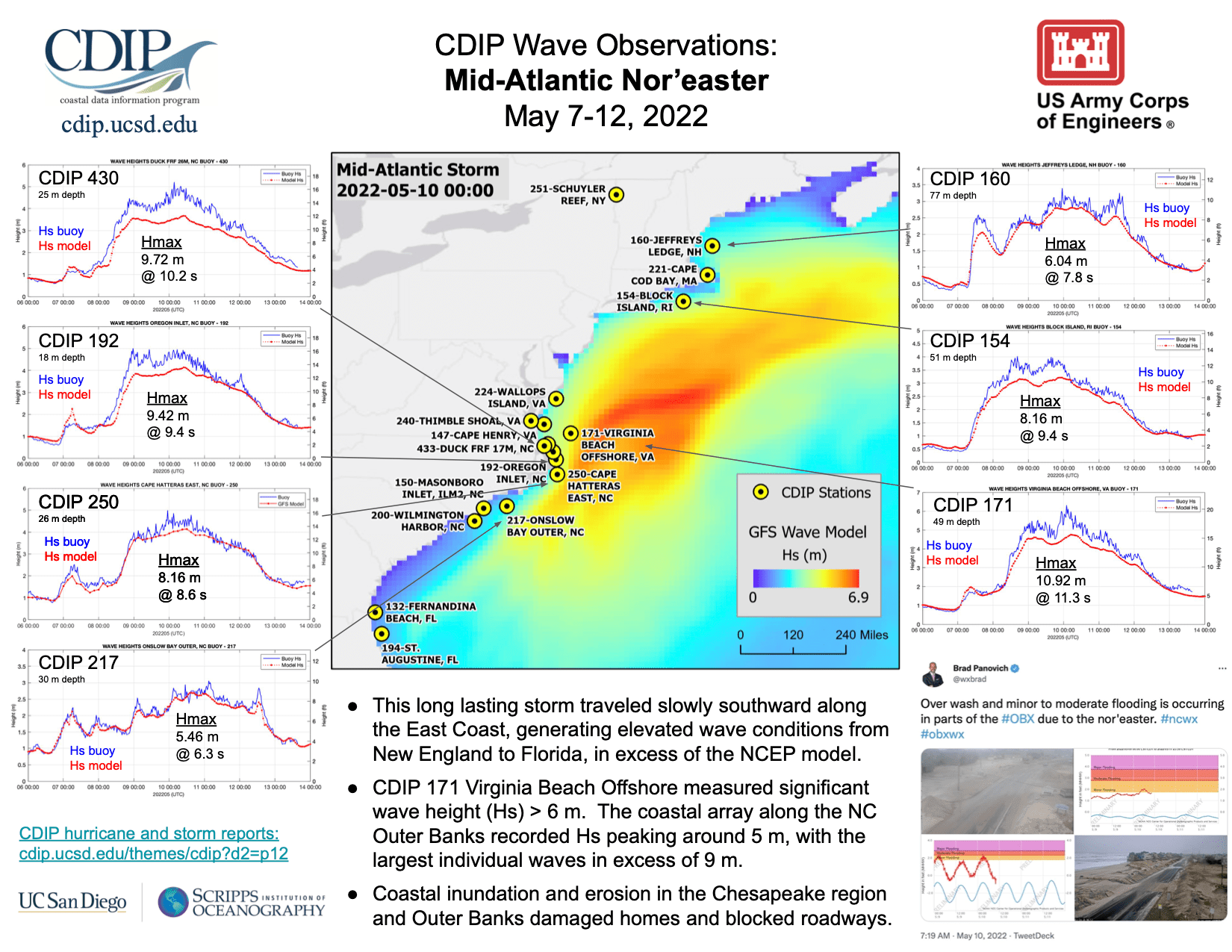
Tropical storm Claudette made landfall in LA before moving offshore of NC.
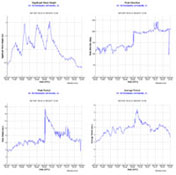
A few CDIP stations observed greater than predicted wave heights.
One of CDIP’s newest stations, #256, was installed just a few weeks prior.
2020 Storm Season
The 2020 hurricane season was the most active on record, with 30 named storms, 13 of which were hurricanes.
More on the 2020 hurricane season (Shore & Beach) ...
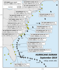
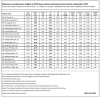
Hurricane Dorian - September 2019
Hurricane Dorian was the most intense tropical cyclone on record
to strike the Bahamas, and is regarded as the worst natural
disaster in the country's history. It was also one of the
most powerful hurricanes recorded in the Atlantic Ocean in terms
of 1-minute sustained winds, with these winds peaking at 185 mph (295 km/h).
It was the fourth named storm, second hurricane, and the first major
hurricane of the 2019 Atlantic hurricane season.
More from wikipedia
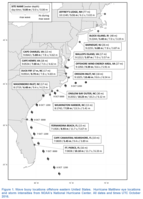
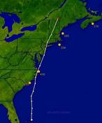
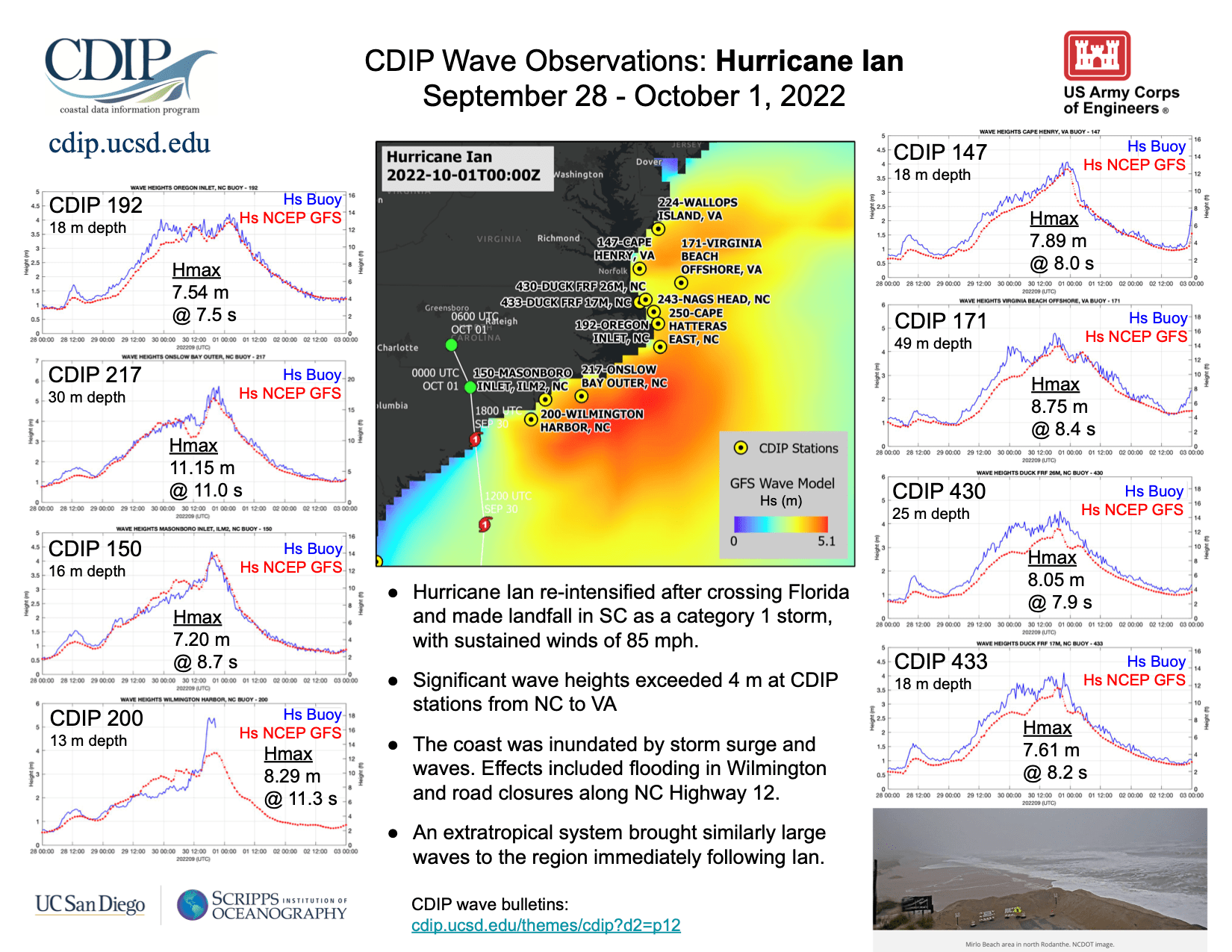
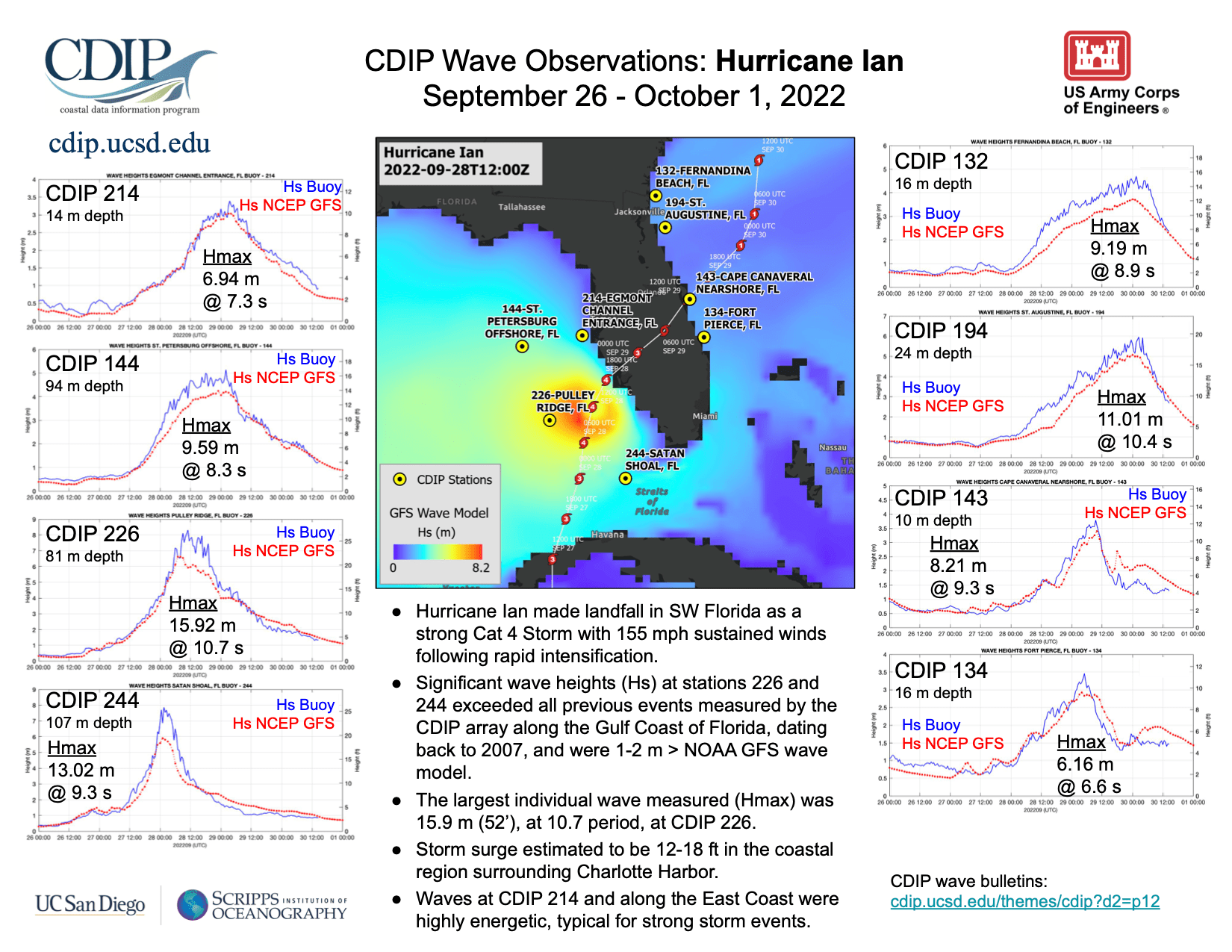
Wave data were recorded by 19 CDIP stations as the storm moved from south
to north along the Atlantic coast from August 24 - September 10.
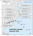
Hurricane Florence - September 2018
Hurricane Florence was the first major hurricane of the 2018 Atlantic
hurricane season. It made landfall in North Carolina in mid-September.
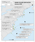
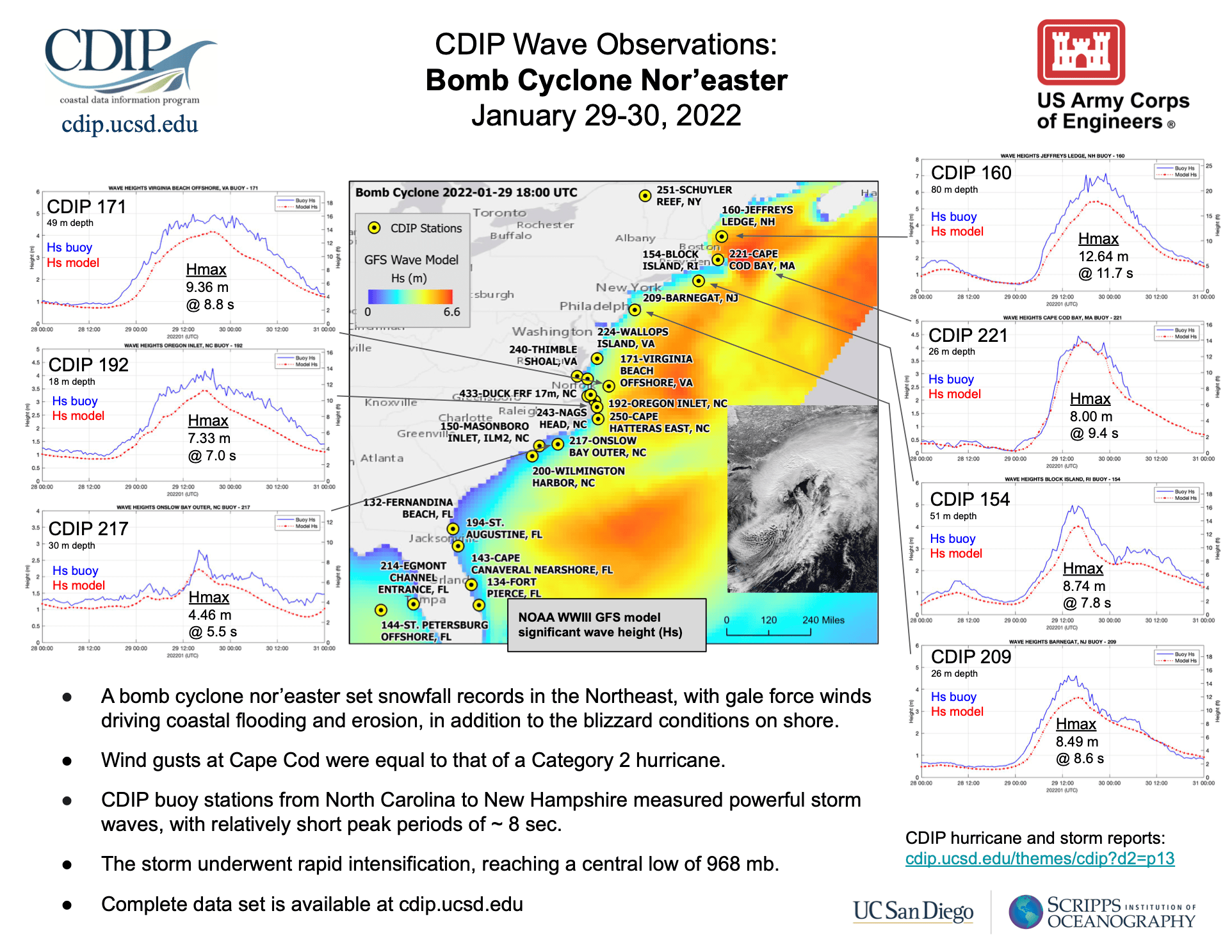
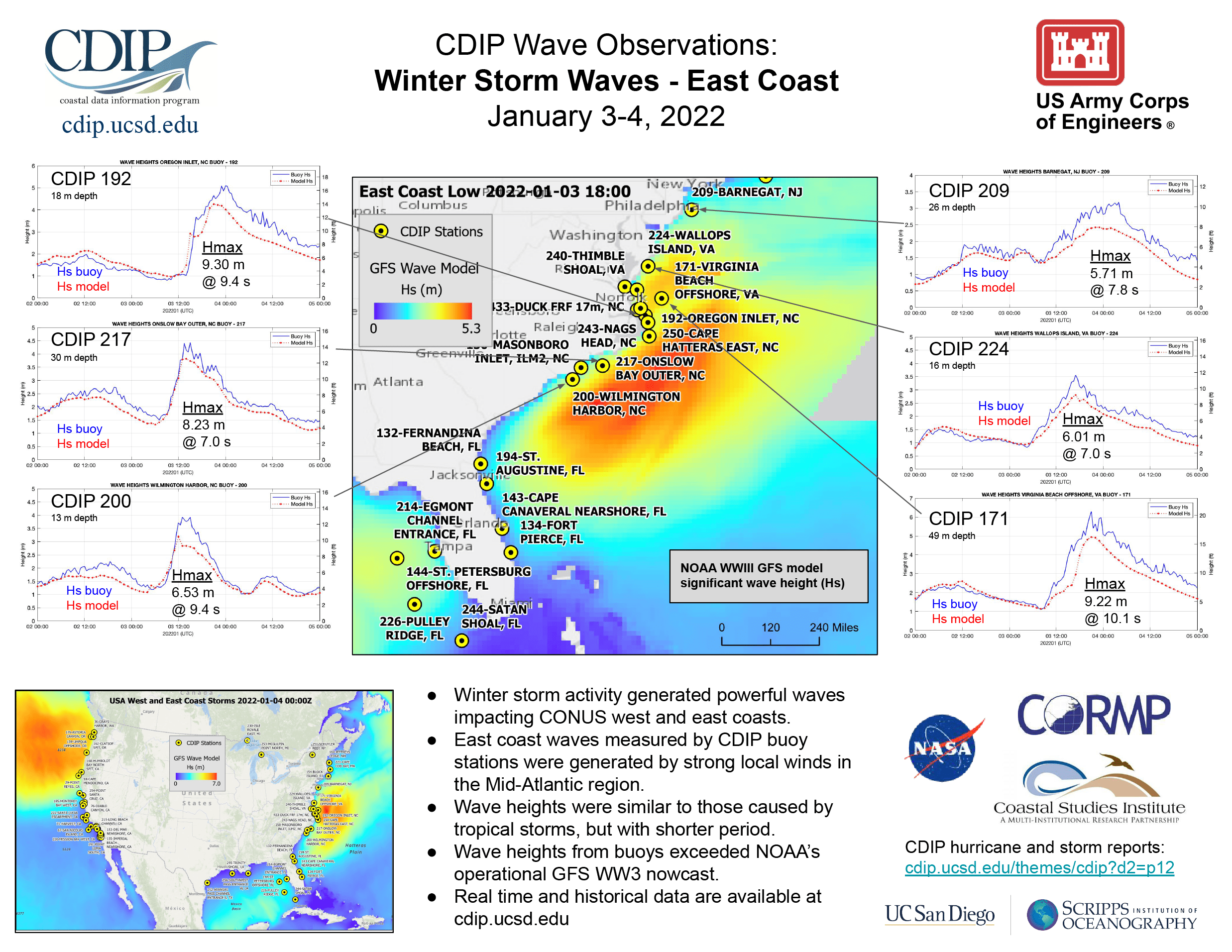
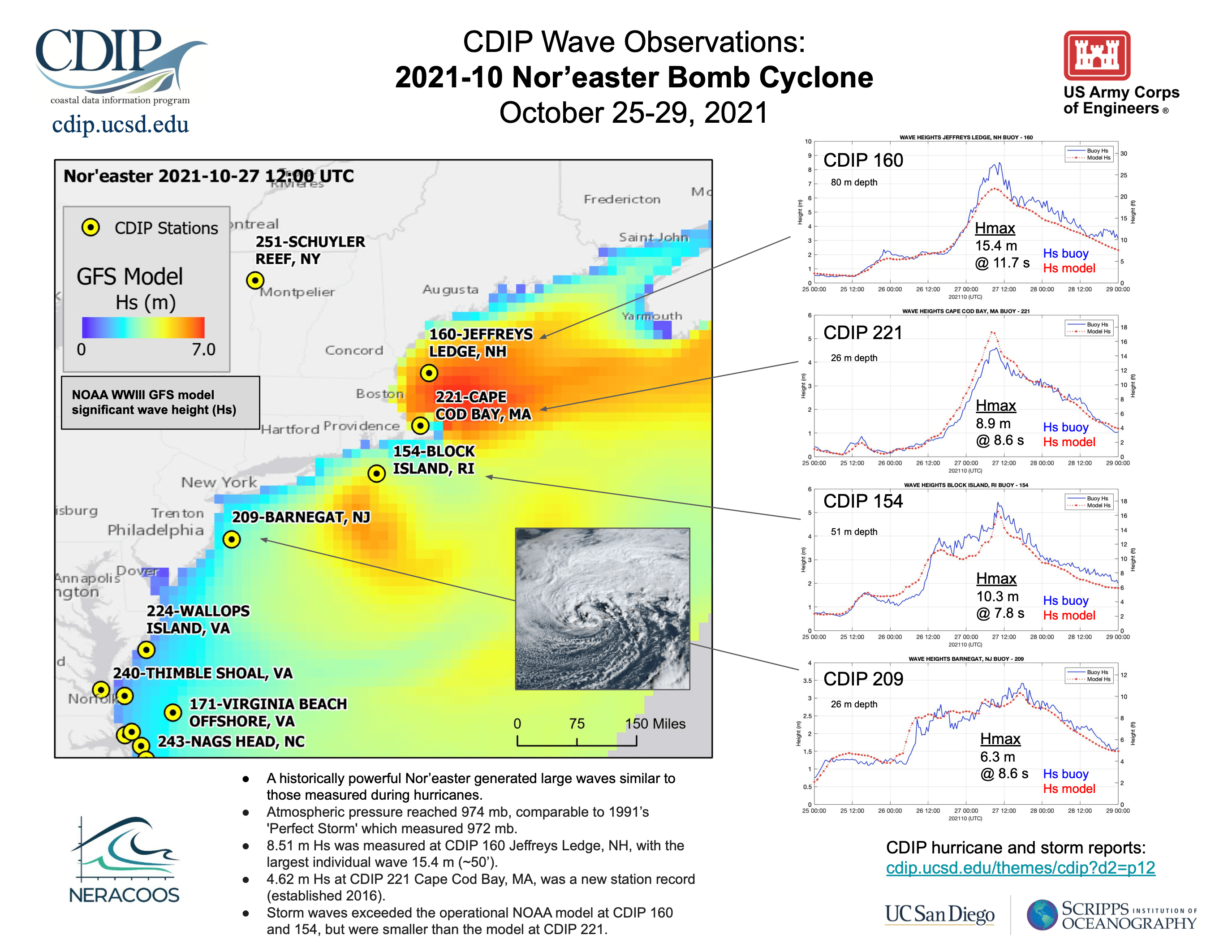
Bomb Cyclone Nor'easter - January 2018
While not technically a hurricane, the January 2018 North American Blizzard
generated winds and waves of comparable magnitudes. Large waves from this
event were measured by a dozen CDIP buoys stretching from North Carolina to
New Hampshire.
Shore & Beach article
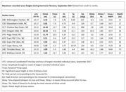
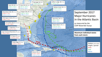
2017 Atlantic Hurricane Season
2017 was an extremely active hurricane season in the Atlantic. The most significant
impacts came from three major hurricanes in September: Irma, Jose, and Maria.
CDIP's buoy network made extensive measurements of these events.
Shore & Beach article
Hurricane Matthew - October 2016
In early October 2016, Hurricane Matthew moved north from the Carribean Sea and traveled
up the east coast before dissipating off of Virginia. More than a dozen CDIP buoys
recorded waves generated by the storm, measuring significant wave heights of over 20 feet
and individual waves of over 30 feet.
Shore & Beach article
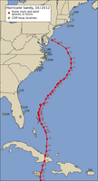
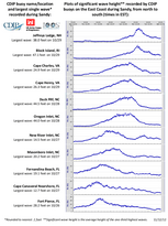
Hurricane Sandy - October 2012
In late October 2012, Hurricane Sandy moved north from the Carribean Sea
and traveled up the east coast. Thirteen CDIP buoys recorded waves
generated by the storm, measuring significant wave heights of over
30 feet and individual waves of over 45 feet.
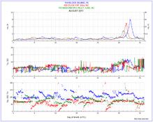
Hurricane Irene - August 2011
In late August 2011, Hurricane Irene traveled up the East Coast,
making landfall in North Carolina and again in New Jersey.
CDIP buoys from Florida up to Canada recorded the impact of
the storm. The largest waves recorded were at CDIP's Block Island, RI
buoy, with a significant wave height of over 30 feet and individual
waves up to 48 feet. CDIP's Duck, NC buoy recorded a significant
wave height of over 25 feet and individual waves up to 43 feet.
In all, five CDIP buoys measured significant
wave heights of over 4 meters (13 feet) from Irene.
Hurricane Dean - August 2007
In late August 2007, Hurricane Dean made its way through the Carribean Sea.
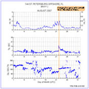
CDIP buoy 144, approximately 82 nautical miles offshore Tampa Bay, FL in the
Gulf of Mexico, recorded swell from Dean as the storm moved west of Cuba's
shadow.
